SEER BHARAT FOUNDATION · PUNE ENVIRONMENTAL ATLAS

Urban Ecosystem Health Intelligence System (UEHIS)

Spatial intelligence for understanding urban ecosystem health, canopy infrastructure, thermal exposure, and ecological vulnerability across Pune.
GEOAPIFY ENGINE
search
Radii:
infoPowered by Geoapify. Point-radius study area (500m, 1km, 2km, 5km) — Not an official administrative boundary.
Study Extent331.81 km²
Urban Canopy21.51 km² (6.48%)
Mean UEHI20.21 / 100
grid_4x4250m Orthogonal Cells · EPSG:32643
SYNCHRONIZED
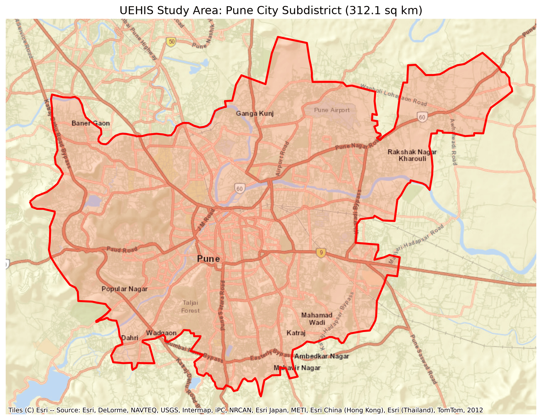
Cartographic study area map of Pune showing 250m grid extent
AUTHORITATIVE BASELINE CARTOGRAPHY
Risk Category:
CriticalHighModerateLow
PUNE 250M GRID · EPSG:32643
Total Spatial Blocks5,309
Scorable Blocks5,298
Excluded Perimeter11 Blocks
Standing Carbon493,093.69 t
Cartographic CRSEPSG:32643 UTM 43N
ANALYTICAL WORKBENCH

Modular Scientific Capabilities

01GEOSPATIAL

GIS Spatial Workspace

Interactive 250m orthogonal grid cartography. Inspect biophysical parameters, canopy masks, and thermal exposure across Pune.

Launch GIS Workspacearrow_forward
02REGISTRY

Terrestrial Carbon Stock

Biomass allometry and standing terrestrial carbon registry across 5,309 blocks calibrated to 2024 satellite baselines.

View Carbon Stock Registryarrow_forward
03REMEDIATION

Candidate Planting Opportunities

Candidate planting allocation algorithm strictly enforcing the 10-metre spacing constraint across eligible unpaved soils.

lockRestricted to Authorized Researcher / Admin accounts
04PROJECTIONS

Systemic Intervention Scenarios

Hypothetical scaling curves modeling incremental canopy and carbon yield under theoretical 100K, 250K, and 500K sapling volumes.

Inspect Intervention Scenariosarrow_forward
SCIENTIFIC RIGOUR & PROVENANCE

Methodological Architecture

A
Satellite Data Ingestion: High-resolution multispectral imagery pipeline calibrated for surface reflectance and thermal radiance.
B
Semantic Segmentation: Deep architectural partition identifying impervious footprint, tree crown perimeter, and water conduits.
C
Feature Engineering: Synthesizing biophysical signals across the Pune 250m orthogonal reference coordinate system (EPSG:32643).
D
UEHI Scoring: Multi-criteria decision formulation weighting ecological deficit against ambient vulnerability.
E
Carbon Estimation: Allometric biomass equations translated into verified baseline standing mass and simulated planting yields.
INSTITUTIONAL COLLABORATION

SEER Bharat Foundation, Pune

Developed in active partnership with SEER Bharat Foundation to establish an open, authoritative spatial evidence base for ecological remediation, urban forestry planning, and heat vulnerability mitigation across the Pune metropolitan region.

PUNE ATLAS · PRODUCTION 2026EPSG:32643